ABSTRACT
Design codes as a tool to define the urban design processes through morphological elements of urban form come to the fore as a control mechanism within a context in which the basic units of the urban form and the coherence between them are defined. Recently, the design codes are considered as a part of a new approach towards urban morphology that parametrically defines the relationship between the basic elements of the urban form.
The aim of this paper is to display the process and result of a design research conducted in 2014-2015 academic year of METU Urban Design Master Programme. The research posits an approach in its locus, namely parametric morphology.
Parametric morphology approach is used in the purport of re-defining the components of the urban form through gaugeable compositional or structural relations between them. Thus, in the following of this paper, the design research leading to the formation of code index (parametric definitions of the morphological elements of urban form) and code matrix (the performative definitions of urban design codes) are presented. Based on matrix, generative urban codes are produced within a predefined urban design framework and principles. To observe whether the generative codes serve to reach unique end-products (design variations), they are tested on a hypothetical case studies.
1. INTRODUCTION
Etymologically, the code as a term was evolved from the Latin word of caudex, which means “book of laws”. In parallel with its root, it is, now, lexically defined as “systemic statement of a body of law”. Its originary meaning refers to its use in the domain of law; however, in the course of time, it has been entered in different domains such as genetics, computer programming, semiology and architecture with different meanings and attributes (Gleiniger & Vrachliotis, 2010). For instance, codes may behave as regulatory in law, communicative in semiology, or generative in computer programming and genetics.
As to urban planning, the use of codes is traced back to 14th century when a set of codes was annunciated as the regulations regarding the formation of cities in the American colonization period under the reign of Spain, known as the Laws of the Indies (Melendo and Verdejo, 2008). These regulations were attributed to as “the first town planning law in the modern era” (Benevolo, 1980, as cited in Carmona, et al., 2006). They were also been deemed as urban codes which establish the relationship between urban elements, rather than being rules for design of the buildings. The laws of the Indies consists of 148 ordinances. To illustrate, Ordinance 112 states that: “The main plaza is to be the starting point for the town […] the plaza should be square or rectangular.” and Ordinance 113 states that “The size of the plaza shall be proportioned to the number of inhabitants […] and it shall be not less than two hundred feet wide and three hundred feet long, nor larger than eight hundred feet long and five hundred and thirty feet wide. A good proportion is six hundred feet long and four hundred wide.”
Urban coding in the modern context of urban design operates as a tool to control the urban form produced according to the urban development pattern (Baş, 2003; Ünlü, 1999). Yet, it does not only pertain to modern era. Even in the antiquity, Vitrivius, in his work titled Ten Books on Architecture, presents the codes for urban order, public and private buildings and building materials (Carmona, et al., 2006). With the evolution of the approaches to urban planning and urban design, the use of urban coding were exposed to alterations. According to Baş (2003), by the changing economic conditions of West after the modernist era, the redefinition of the relationship between planning and design led to posit urban design outside the boundaries of urban planning, and, hence, urban coding has been given a new role within this newly shaped relation.
In 2014-2015 academic year of METU Urban Design Master Programme, urban coding and design codes have been considered as a control mechanism for the design process within a context in which the basic elements of the urban form and the coherence between them are defined. In the following, this paper continues with the rationale behind the formation of code index and code matrix.
2. PARAMETRIC MORPHOLOGY: An Interface Openıng Morphology to Desıgn
Through parametric morphology approach which is employed to conduct the design research, a code index and code matrix were produced to provide the layout for the formation of the parametric language of the urban form and to define the urban codes with their expected performances.
2.1 Code Index: Parametrıc Defınıtıons of the Morphologıcal Elements of Urban Form
The main aim of the research is to find out the relationship between morphological elements of urban form. In the consequence of a wide literature research, the basic elements of urban morphology are defined as follows:
Street as a public thoroughfare in a built environment (Roth, 2001)
Block as the smallest unit of development that gives access to plots by streets or to streets by plots
Plot as a piece of land that represents “the smallest expression of undivided ownership” (Conzen & Conzen, 2004, p. 75)
Building as any relatively permanent enclosed structure on a plot of land usually having covering surfaces, vertical surfaces and openings
However, the basic definitions of these morphological elements is incapable of establishing a gaugeable relationship between them. Therefore, the elements of the urban form are re-defined by splitting them into smaller components. Accordingly;
A street has sidewalk, lane, street median, frontage zone, pedestrian thorough zone, street furniture zone, buffer zone, travel lane and median strip (Figure 1).

Figure 1. The components of street
An urban block has edges and corners (Figure 2).

Figure 2. The components of urban block
A plot has edges and corners (Figure 3).

Figure 3. The components of plot
A building has edges, corners, surfaces and openings (Figure 4 and Figure 5).

Figure 4. The components of building

Figure 5. The components of building
The code index is not limited to the definitions of the elements. In the following steps of the code index formation, the definitions through components fail to describe the existing typologies of urban elements. Therefore, a column is added to the index, which categorizes the urban elements with respect to their attributes. Each attribute in the index is measured by a parameter. Oxford Dictionary defines the term parameter as “a numerical or other measurable factor forming one of a set that defines a system or sets the conditions of its operation”. Figure 6 shows the attributes of each morphological element.

Figure 6. Attributes of the elements of urban form
For instance, for a plot, proportion attribute, is measured by frontal edge/lateral edge ratio whose parameter is length. Proportion attribute characterizes the plot as deep/shallow or narrow/wide. Figure 7 illustrates the proportion attribute.

Figure 7. Proportion attribute of plot in code index
Code index is the table that enables to construct the language of the urban morphology. Yet, it is not sufficient to illustrate the relationality of urban components with one another. To that end, a code matrix was prepared so as to build the compositional and structural relationality between urban elements.
2.1 CODE MATRIX: THE PERFORMATIVE DEFINITIONS OF URBAN DESIGN CODES
Code matrix is a rectangular array of urban codes in rows and columns. Each relation between the urban elements corresponds to an urban code which is parametrically established. That is to say that each relation is the parametric definition of a generative urban code.
As an example, variety in depth code is the relation between lateral edge of the plot and lateral surface of the building, which is defined based on the parameter of length. Any changes in the length of the lateral side of the plot alters the extension potentiality of the building. As a result, one of the expected performances of variety in depth code is to increase the variety in the configuration inside the urban block, in other words it provides opportunity to form various courtyards within the block.
Figure 8 shows the notation of variety in depth code in code matrix.

Figure 8. Variety in depth code
Based on the parameters, urban codes display flexibility in their performances. In other words, there is no precise performance that a code may provide. If its parameter changes, its performance varies accordingly. Thus, the expected performances were also given in the matrix. Furthermore, it is important to indicate how to read code matrix. If peered at, it is noticed that the code produced by the relation of plot with building is dissimilar with the one produced by the relation of building with plot. Code matrix and the correlation between urban elements are structured as seen in Figure 9.

Figure 9. Structure of code matrix
By the formation of generative urban codes through such code matrix, it is assumed that the urban areas with the desired performances can be designed.
3. CASE STUDIES
Bostancı neighborhood in Kadıköy district of Istanbul was selected as a hypothetical study area for the design research conducted in 2014-2015 academic year of METU Urban Design Master Programme.
Through the test process, a programming language, called Grasshopper 3D was used to create design algorithms and to visualize the variations produced.
3.1 CASE STUDY #1: CONTINUITY IN TRANSITIONARY SPACE STRUCTURE
Case study #1 adopts a street based urban design approach as opposed to a block-based planning. It focuses on the characteristics of the “street” and its capabilities to foster public life.
3.1.1 DESIGN FRAMEWORK
The variation test aims to address the following issues:
Separating public and private domains from each other
Providing an integrity within domains
Ensuring the transitions and barriers
Figure 10 shows the transformation of study area in accordance with the design codes and design framework.

Figure 10. Transformation of study area (Left: existing situation, Middle: smooth transition, Right: intersection)
As shown in Figure 11, it is a concept based on the continuity in transitionary space structure, and uses morphological interspaces as a tool to provide variety in pedestrian movement pattern both in horizontal and vertical space volumes.

Figure 11. Design concept based on horizontal and vertical space volumes such as bridges, canopies, and terraces
3.1.2 DESIGN ALGORITHM
In parallel with the aim of fostering public life on and above the street level, frontal facades of the buildings in each level are recessed and extended from the street median in order that the volumetric transitionary spaces are formed in each street level. To that end, the main relationship that is established between the elements of the urban form in this design algorithm is between the street and building. The parameter on which street-building relation is established varies in each code constituting the design algorithm. Accordingly,
The design algorithm starts with the designation of the points where primary street intersects with secondary streets.
Code 01: The number of intersections on the secondary streets determines the hierarchy (magnitude) of the intersection points on the primary street (Figure 12).
Elements: Street-street
Parameter: number of intersections on the secondary streets

Figure 12. Hierarchy (magnitude) of the intersection points on the primary street
In each street segment –the segment of street between two intersection points on the primary street-, a target point is designated with a magnitude and location which are determined by the magnitude of the attractor points.
Code 02: The vertical surface of the building on street level is undulated (only recessed) according to the magnitudes of target points designated, which is called expansion factor on the street level (Figure 13).
Elements: Street-Building
Parameter: Expansion factor

Figure 13. Expansion factor on the street level
Since the building envelope is kept the same in each step of the algorithm, any changes in the coverage of plot by floor area of the building directly impacts the height of the building.
Code 03: To create interspaces above the street level, the target points designated on the street level are moved to the upper levels (Figure 14).
Elements: Street-Building
Parameter: Expansion factor

Figure 14. Expansion factor above the street level
Since the form and distribution of undulation in each level vary, the variations in volumetric horizontal and vertical spaces are created by means of recessions and extensions.
Code 04: To increase horizontal interactions between the street levels, connections are formed where the distance between opposite vertical surfaces is the most closest. Similarly, the vertical interactions are provided by vertical space volumes connecting the different street levels (Figure 15).
Elements: Street-Building
Parameter: Distance between vertical surfaces of buildings

Figure 15. Horizontal and vertical connections
3.1.3 Variations
At the end of the design algorithm, generative urban codes provide unique end products (design variations).
Figure 16 and 17 show the design variations produced by the generative urban codes. Figure 18 is a three dimensional view of variation 02.

Figure 16. Variation 01

Figure 17. Variation 02

Figure 18. Three dimensional view of variation 02
3.2. CASE STUDY #2: CONTINUITY IN TRANSITIONARY SPACE STRUCTURE
A block based urban design approach is operated in case study #2. The approach of this study is to create open spaces within a hierarchical order consisting of public, common and private spaces on different levels of buildings. Rather than designing solids, voids are articulated within the urban block as design tools, in order to explore the block based design variations.
3.2.1 DESIGN FRAMEWORK
Case study #2 adopts the following design themes:
On the ground level: creating a public courtyard system by increasing the permeability of the block. Figure 19 shows the transformation of study area on the ground level.

Figure 19. Transformation of study area on the ground level (Left: Existing situation Middle: Courtyard system on the ground level, Right: Increased permeability of the courtyard)
Above the ground level: creating common and private spaces on each level of the buildings. Figure 20 shows the transformation of study area above the ground level.

Figure 20. Transformation of study area above the ground level -Common and private spaces on each level
3.2.2 DESIGN ALGORITHM
In parallel with the main design principles, the generative urban codes are collected under three headings as follows:
Codes to control the form and proportional distribution of voids in total envelope and in each level of block
Codes to control the articulation of form, spatial and proportional distribution of voids on the ground level
Codes to control the spatial distribution and height of voids above ground level
Code 01:
Form of the voids: The block is placed on a grid layout consisting of 5×5 m2 units without any changes in the existing plot layout (Figure 21).
Figure 21. 5×5 grid layout on the existing plot layout
The grid system provides effective use of space within the urban block.
Proportional distribution of voids in the total envelope and in each level of block: In the total envelope of block, void percentage is defined as 33%, according to the existing total Building Coverage Ratio. Starting from the ground level of the building and moving upwards, the total percentage of voids is distributed with an increasing percentage rate (Figure 22).
Elements: Plot-Building
Parameter: Average Ratio (BCR/Building Height)

Figure 22. The distribution of total void percentage with an increasing percentage rate
The percentage rate of voids is increased in order to create more common and private spaces on upper levels of the buildings.
Code 02:
Spatial distribution of voids on the ground level: the attractor points are defined where lateral edges of plot intersect with block median. In order to specify the center of each courtyard, the impact area of each attractor point is illustrated by color red. The public courtyards emerge from the center of the most intersected impact areas, illustrated by brighter red and mark X. The most intersected impact areas are the most accessible points on the block median (Figure 23).
Elements: Block-Plot
Parameter: Number of intersections of impacted areas

Figure 23. Spatial distribution of voids on the ground level
Proportional distribution of voids on the ground level: The void percentage of ground level which is predefined according to proportional distribution of voids in the total envelope is distributed to two centers in proportions with 1/3 and 2/3 (Figure 24).

Figure 24. Proportional distribution of voids on the ground level
Articulation of form of voids on the ground level: In order to provide variation in the form of courtyards, 5×5 grid units are attached to the voids on the ground level (Figure 25).

Figure 25. Articulation of form of voids on the ground level
Code 03:
Spatial distribution of the voids above ground level: the voids above the ground level, named as carved spaces, are randomly distributed in each plot. If the carved spaces intersect with vertical surface of the building, they are characterized as private spaces. If not, carved spaces are characterized as common spaces (Figure 26).

Figure 26. Spatial Distribution of the voids above ground level
Height of the voids above the ground level: the height of the private spaces is determined by the fact that height of building level is equal to or larger than width of the void. Common spaces are open up to the highest level of building (Figure 27).
Element: Building-Building
Parameter: height of building level/width of void ≥ 1

Figure 27. Height of the voids above the ground level
The determination of height of the voids by the ratio given above provides effective lighting for each private and common spaces.
3.2.3 VARIATIONS
In order to test the capacity of generative urban codes to create alternative design solutions for desired performances, a variation matrix is prepared, which is formed based on number of floors and void percentage.
In the column of matrix, void percentage in total envelope of block is kept constant, while the number of floors varies. In the row of matrix, the number of floors is kept constant while the void percentage in total envelope of block varies. Figure 28 illustrates the variation matrix.

Figure 28. Variation matrix
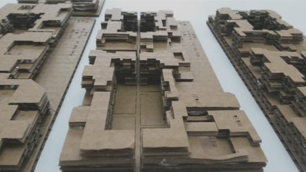
Figure 29 illustrates the three dimensional view of the design variation.
Figure 29. Three dimensional view of the variation
4. CONCLUSION
Adopting parametric morphology approach, this urban design research concentrates on generating complex urban fabrics with the design codes. In order to systematically define generative urban codes with the aspects of urban morphology, a code index constituting the language of complex urban forms and a code matrix correlating the different elements of urban form on a performative basis, were produced.
As a follow up phase of the design research, the generative urban codes were tested on a hypothetical context in Kadiköy district of Istanbul, Turkey. The tests were aimed to reach more than one unique end product. In line with the digital form generation techniques (Grasshopper 3D), variations in the formation of block were produced within the context of the algorithmic thinking.
The design research conducted in 2014-2015 academic year of METU Urban Design Master Programme reconsiders the intrinsic relationship between code and design, and operates a code based design to generate and control the complex urban forms.
5. ACKNOWLEDGEMENT
This research is a collaborative work of UD studio members and Parametric Urban Design class in 2014-2015 academic year of Urban Design Master Programme. Therefore, we owe our colleagues, Elif Eda Uzunoğulları, Ilgın Kurum, Sadık Deniz Akman, Ensar Temizel, Nilay Nida Can and Didem Yönter and our professors Mehmet Adnan Barlas, Olgu Çalışkan, Cansu Canaran, Yavuz Baver Barut, Gökhan Ongun a great gratitude.
REFERENCES
Baş, Y., 2003. Designing urban space with the tools of the development legislation. Ankara: METU.
Carmona, M., Marshall, S. & Stevens, Q., 2006. Design codes: their use and potential. Oxford: Elsevier.
Conzen, M. R. G. & Conzen, M. P., 2004. Thinking about urban form: papers on urban morphology, 1932-1998. Oxford: Peter Lang.
Gleiniger, A. & Vrachliotis, G., 2010. Code: between operation and narration. Basel: Birkhaeuser.
Leonard, W.R & Crawford, M. H. (Eds.). (2002). Human Biology of pastoral populations. Cambridge, NY: Cambridge University Press.
Melondo, J.M.A. and Verdejo, J.R.J. (2008). Spanish – American Urbanism Based on the Laws of the Indies: A Comparative Solar Access Study of Eight Cities. [Presentation]. Paper presented at 25th Conference on Passive and Low Energy Architecture. Dublin, Ireland.
Roth, L., 2001. American architecture: a history. Boulder, CO: Westview Press.
Ünlü, T., 1999. Urban Coding as a Tool to Control Urban Form. Ankara: METU.

Leave a comment